Detail Gps Map 76csx Murah, Hub 085693822209
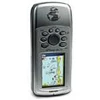
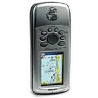
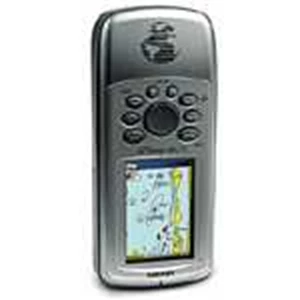
The GPSMAP 76CSx is a refreshing upgrade of the GPSMAP 76CS, one of our most popular models for outdoor and marine use. This unit features a removable microSD card for detailed mapping memory and a waterproof, rugged housing. The microSD card slot is located inside the waterproof battery compartment. Users can load map data and transfer routes and waypoints through the unit’ s fast USB connection.
In addition, this unit features a new, highly sensitive GPS receiver that acquires satellites faster and lets users track their location in challenging conditions, such as heavy foliage or deep canyons. The GPSMAP 76CSx also incorporates a barometric altimeter for extremely accurate elevation data and an electronic compass that displays an accurate heading while standing still.
Considered the mainstay among serious outdoor enthusiasts, the GPSMAP 76CSx and GPSMAP 76Cx offer a large color TFT display and turn-by-turn routing capability. These units also float when dropped in the water. Each unit comes with a blank 128 MB microSD card. Owners of these new x-series handhelds can also purchase new microSD cards that are pre-loaded with MapSource® Topo and inland lake maps, BlueChart® marine cartography, and City Navigator™ street maps.
Features:
* New high-sensitivity WAAS-capable GPS receiver by SiRF
* Built-in quad-helix receiving antenna with remote antenna capability
* Unit dimensions: 2.7” W x 6.2” H x 1.4” D
* Display: 1.5” W x 2.2” H, 2.6” -diagonal, 256-color, transflective TFT ( 160 x 240 pixels)
* Weight: 7.6 ounces with batteries ( not included)
* Sensors:
o Electronic compass displays accurate heading while standing still
o Barometric altimeter with automatic pressure trend recording
* microSD card slot allows for storage of optional MapSource detail ( 128 MB microSD included)
* LED backlit display and keypad
* Battery life: 18 hours ( typical use) using two AA alkaline batteries
* Includes a built-in Americas autoroute basemap with automatic routing capabilities, including highways, exits, and tide data ( USA only)
* Internal memory is preloaded with a marine point database
* 1, 000 user waypoints with name and graphic symbol; 50 reversible routes
* Position formats include Lat/ Lon, UTM, Loran TDs, Maidenhead, MGRS, user grid, and more
* Audible alarms for anchor drag, arrival, off-course, proximity waypoint, and clock
* Large-numbers option for easy viewing; dual-position display mode
* Trip computer provides odometer, stopped time, moving average, overall average, total time, max speed, and more
* 10, 000-point automatic track log; 20 saved tracks ( 500 points each) let you retrace your path in both directions
* Elevation computer provides current elevation, ascent/ descent rate, minimum/ maximum elevation, total ascent and descent, average and maximum ascent and descent rate
* Navigation instructions can be shared with repeaters, plotters, and autopilots using NMEA protocols through the dedicated serial port.
* Built-in celestial tables for sun and moon calculations and the best times to fish and hunt
* Compatible with most MapSource products including BlueChart, City Navigator, U.S. TOPO 24K, U.S. TOPO, and Recreational Lakes with Fishing Hot Spots
* Water resistant: IEC 60529 IPX7 standards
* Unit floats when dropped in the water
Specifications
Navigation Features
Waypoints/ Icons: 1000 with name and graphic symbol, 10 proximity
Routes: 50 reversible routes with up to 250 points each, plus MOB and TracBack® modes
Tracks: 10K point automatic track log; 20 saved tracks let you retrace your path in both directions
Trip computer: Current speed, average speed, resetable max. speed, trip timer and trip distance
Tables: Built-in celestial tables for best times to fish and hunt, sun and moon rise, set, and location
Map datums: More than 100 plus user datum
Position format: Lat/ Lon, UTM/ UPS, Maidenhead, MGRS, Loran TDs and other grids, including user grid
GPS Performance
Receiver: High sensitivity SiRFstarIII™ GPS receiver, WAAS enabled; continuously tracks and update your position
Acquisition times:
* Warm: < 1 sec
* Cold: < 38 sec
* Factory Reset: < 45 sec
Update rate: 1/ second, continuous
GPS accuracy:
* Position: < 10 meters, 95% typical
* Velocity: 0.05 meter/ sec steady state
DGPS ( WAAS) accuracy:
* Position: < 5 meters, 95% typical
* Velocity: 0.05 meter/ sec steady state
Dynamics: 4 g’ s
Protocol messages: NMEA 0183 output protocol
Antenna: Built-in quad helix receiving antenna, with external antenna connection ( MCX)
Moving Map Features
Basemap: ( GPSMAP 76Cx & 76 CSx) built-in routable basemap ( North and South America) with cities, highways, interstates, local thoroughfares, and secondary roads within metro areas, interstate exit services, airports, rivers, lakes, coastlines, and tide stations
Uploadable maps: ( GPSMAP 76Cx & 76 CSx) Accepts up to 1 GB ( Gigabytes) microSD™ data card for downloaded map detail from a variety of optional MapSource® media ( extra microSD data card optional)
Electronic Compass Feature
Accuracy: ± 2 degrees with proper calibration ( typical) ; ± 5 degrees extreme northern and southern latitudes
Resolution: 1 degree
Barometric Altimeter Features
Accuracy: 10 feet with proper calibration ( user and/ or automatic calibration)
Resolution: 1 foot
Range: - 2, 000 to 30, 000 feet
Elevation computer: current elevation, resetable minimum and maximum elevation, ascent/ descent rate, total ascent/ descent, average and maximum ascent/ descent rate
Pressure: local pressure ( mbar/ inches HG) , 48-hour automatic pressure trend recording
Power
Source:
* Up to 30 hours ( 76Cx)
* Up to 20 hours ( 76CSx)
Battery life: Up to 16 hours; 10 hours typical on GPSMAP 76 CSx
Physical
Size: 6.2” H x 2.7” W x 1.2” D ( 15.7 x 6.9 x 3.1 cm)
Weight: 7.7 ounces with batteries ( not included)
Display: 1.6 x 2.2 inches ( 4.1 cm x 5.6 cm) ; 256 – color transflective TFT ( 160 x 240 pixels)
Case: Fully gasketed, high impact plastic allow, waterproof to IEC 60529 IPX7 standards
Temperature range: 5° F to 158° F ( -15° C to 70° C)
User data storage: Indefinite, no memory battery required
Specifications are subject to change without notice.
Contact Person ( 24hours ) :
http: / / hellogps.indonetwork.co.id
e-mail : mromy79@ yahoo.com
( ready 24 hour)
Hub : Rommy
Hp : 085693822209
Tlp : 021-93197759
Tampilkan Lebih Banyak